

Fall 2023
As the legal and regulatory need for environmental justice analyses grows, lawmakers, community groups, and companies are relying more heavily on GIS tools developed by federal and state agencies to evaluate areas of concern in communities throughout the United States.
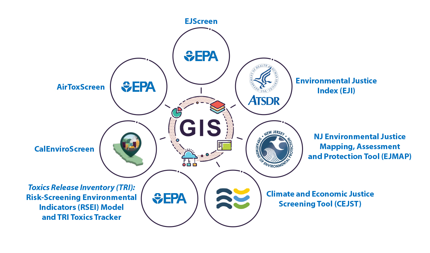
Environmental Justice (EJ) is a growing area of interest and focus of decision-makers and community organizations across the United States (US), and the Biden-Harris Administration has spurred much EJ-related activity in the past few years (Harvard Law School, 2023). To aid in these efforts, many tools, such as the US Environmental Protection Agency (US EPA) EJScreen, have been developed by federal and state agencies to review the complex set of stressors and demographic factors that contribute to EJ concerns for a community. EJ tools generally share a map-based system, also referred to as a geographic information system (GIS), and data are shared between many tools. In effect, anyone with GIS software can access the data used in the EJ tools in one centralized location (see Figure).
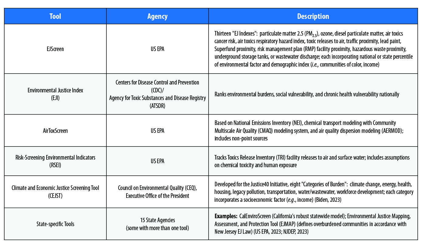
While EJ tools rely on overlapping data sources, each tool uses metrics and data sets of interest to the stakeholder and/or specific to the tool’s purpose. For example, all prominent EJ tools incorporate environmental factors (e.g., ambient particulate matter [PM] in an area, proximity to National Priority List [Superfund] sites, or air toxics cancer risk). In addition, some EJ tools also incorporate health factors (e.g., asthma or cancer prevalence) and, increasingly, climate change-related factors (e.g., areas at risk of sea level rise, flooding, and/or wildfires) (see Table).
EJ tools are useful because they are easy to use, provide transparency, and are publicly available. In addition, having access to EJ tools removes the burden of high-level data analysis and modeling from community groups, agencies, or companies interested in investigating potential EJ concerns. For example, companies that rely on EJ tools to screen areas of interest before beginning a project can potentially avoid introducing EJ-related issues, which may hold up permit applications or pause construction. Corporate stakeholders are also interested in EJ issues near current or future industrial properties, both for community relations and environmental, social, and governance (ESG) concerns. Because of their GIS basis, EJ tools provide a simple way for many stakeholders to view screening-level EJ data at multiple industrial sites or communities in one place.
[C]ompanies that rely on EJ tools to screen areas of interest before beginning a project can potentially avoid introducing EJ-related issues, which may hold up permit applications or pause construction.”
EJ tools have some notable limitations, as sometimes they show different levels of potential concern in the same area. For instance, within a mile of the White House, the Climate and Economic Justice Screening Tool (CEJST) identifies only one disadvantaged census tract, while EJScreen shows multiple census block groups in the same area that exceed the 90th national percentile for half of its thirteen EJ Indexes (see Table above). These disparate results are driven by demographic differences – while CEJST uses income level, EJScreen also incorporates communities of color and, therefore, environmental stressors are weighted differently in these tools depending on demographics.
EJ tools have some notable limitations, as sometimes they show different levels of potential concern in the same area.”
Furthermore, EJ tools provide a high-level view of potential issues affecting an area but, with few exceptions, are not intended to be used to make specific regulatory decisions at a local level because:
As interest in EJ continues to grow, EJ analyses will be increasingly required by laws and regulations and/or requested by shareholders with ESG concerns. Since EJ tools are easy to use and readily available, they provide a good information base for discussions with community groups when EJ issues arise. As a result, EJ tools are a powerful way to view many data sets where modeling and analysis are already available, and because of their GIS basis, the results of multiple EJ tools can be readily overlaid and compared. While EJ tools frequently use much of the same data, each tool has a specific focus; therefore, it is best to review the results of many EJ tools rather than rely on the data from just one.
The authors can be reached at nslagowski@gradientcorp.com and mmayo@gradientcorp.com.
Biden, JR Jr. [US President]. 2023. “Justice40: A Whole-of-Government Initiative.” Accessed on July 18, 2023, at https://www.whitehouse.gov/environmentaljustice/justice40/.
Harvard Law School, Environmental & Energy Law Program (Cambridge, MA). 2023. “Environmental Justice at EPA.” Accessed on July 31, 2023, at https://eelp.law.harvard.edu/ej-tracker-epa/.
National Research Council, Committee on Improving Risk Analysis Approaches Used by the US EPA. 2009. “Implementing cumulative risk assessment.” In Science and Decisions: Advancing Risk Assessment. National Academies Press (Washington, DC). p213-239.
New Jersey Dept. of Environmental Protection (NJDEP). 2023. “What Are Overburdened Communities (OBC)?” July 26. Accessed on July 31, 2023, at https://dep.nj.gov/ej/communities/.
US Census Bureau. 2022. “Decennial Census of Population and Housing by Decades.” August 4. Accessed on July 31, 2023, at https://www.census.gov/programs-surveys/decennial-census/decade.html.
US EPA. 2023. “Additional Resources and Tools Related to EJScreen.” June 26. Accessed on July 31, 2023, at https://www.epa.gov/ejscreen/additional-resources-and-tools-related-ejscreen.